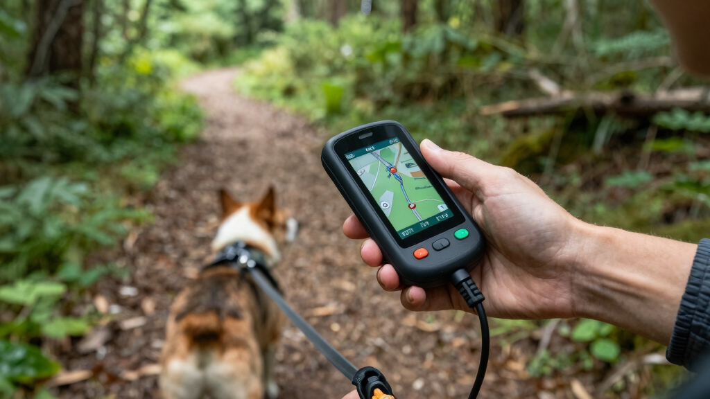

Finding the best handheld GPS for hiking with dogs involves balancing tracking accuracy, durability, and ease of use. The Garmin Alpha 200i stands out as the overall top choice thanks to its advanced tracking and inReach satellite communication. For a more budget-friendly option, the Garmin eTrex 22x offers reliable navigation without extra frills. The main tradeoffs often involve choosing between rugged durability and feature-rich tracking or simpler, more affordable devices. Continue reading for a detailed breakdown of these options and how they compare for your outdoor adventures.

Get pet supplies delivered free with Prime
- Fast, free delivery on millions of items
- Prime Video, Amazon Music and more included
- Member-only deals all year
Complete the kit


Key Takeaways
- The most comprehensive tracking features are found in Garmin Alpha models, especially with inReach technology for satellite communication.
- Durability and waterproofing are essential for hiking with dogs in rough conditions, but often come with a higher price tag.
- Battery life varies significantly; devices with longer battery life are better suited for extended hikes with active dogs.
- Ease of use and quick setup are critical, especially if you’re managing a dog’s training or multiple devices.
- Budget options can still deliver reliable GPS navigation, but may lack the advanced tracking or rugged features of premium models.
| Garmin Alpha 200i Dog Tracking Handheld with inReach Technology |  | Best Overall for Safety and Advanced Features | Display: 3.5-inch touchscreen | Battery Life: up to 20 hours | Range: up to 9 miles | VIEW LATEST PRICE | See Our Full Breakdown |
| Garmin Alpha 10 Handheld Tracking and Training Device |  | Best for Compact Multi-Dog Training and Tracking | Tracking Range: up to 9 miles | Number of Dogs Tracked: up to 20 | Training Stimulation Levels: 18 levels | VIEW LATEST PRICE | See Our Full Breakdown |
| Garmin Alpha 200 Handheld Dog Tracking and Training Device |  | Best for Outdoor Hunting and Long-Lasting Battery Life | Screen Size: 3.5 inches | Connectivity: microUSB | Map Types: Topographical | VIEW LATEST PRICE | See Our Full Breakdown |
| Garmin eTrex 22x Rugged Handheld GPS Navigator |  | Best Rugged and Affordable Basic GPS | Screen Size: 2.2 inches | Display Resolution: 240 x 320 | Map Types: Topographical | VIEW LATEST PRICE | See Our Full Breakdown |
| Garmin Alpha 300i TT25 Bundle |  | Best for Complete Tracking and Emergency Communication | Device Type: Handheld GPS tracking device | Tracking Collar Range: Up to 9 miles | Number of Dogs Tracked: Up to 20 | VIEW LATEST PRICE | See Our Full Breakdown |
| Garmin Alpha 200i GPS Dog Tracking & Training Handheld, Factory Refurbished |  | Best Overall for Advanced Dog Tracking and Remote Safety | Tracking Range: up to 9 miles | Dog Capacity: 20 dogs | Display: 3.5-inch sunlight-readable touchscreen | VIEW LATEST PRICE | See Our Full Breakdown |
| Handheld GPS for Hiking, Waterproof and Rugged, 3.2″ Sunlight Readable Screen, Multi-GNSS Support, USA Topo Maps, 36-Hour Battery |  | Best for Simplicity and Reliability in Tough Conditions | Screen Size: 3.2 inches | Water Resistance: IP66 | Battery Life: up to 36 hours | VIEW LATEST PRICE | See Our Full Breakdown |
| Garmin Alpha 200 Plus Dog Tracking & Training Handheld |  | Best for Long-Range Tracking & Advanced Training | Display: 3.5-inch touchscreen | Range: up to 9 miles | Dog Capacity: 20 dogs | VIEW LATEST PRICE | See Our Full Breakdown |
| Garmin Alpha 300 Handheld, Advanced Tracking and Training Device |  | Best for Premium Features and User Experience | Display: 3.5-inch capacitive touchscreen | Dog Tracking Capacity: up to 20 dogs | Range: up to 9 miles | VIEW LATEST PRICE | See Our Full Breakdown |
| handheld GPS for hiking with dog | Battery Life | Display |
|---|---|---|
| Garmin Alpha 200i Dog Tracking | up to 20 hours | 3.5-inch touchscreen |
| Garmin Alpha 10 Handheld Track | — | — |
| Garmin Alpha 200 Handheld Dog | up to 20 hours | — |
| Garmin eTrex 22x Rugged Handhe | up to 25 hours | — |
| Garmin Alpha 300i TT25 Bundle | — | High-resolution touchscreen |
| Garmin Alpha 200i GPS Dog Trac | — | 3.5-inch sunlight-readable touchscreen |
| Handheld GPS for Hiking | up to 36 hours | — |
| Garmin Alpha 200 Plus Dog Trac | up to 55 hours | 3.5-inch touchscreen |
| Garmin Alpha 300 Handheld | up to 55 hours | 3.5-inch capacitive touchscreen |
More Details on Our Top Picks
Garmin Alpha 200i Dog Tracking Handheld with inReach Technology
The Garmin Alpha 200i earns its place as the best overall choice thanks to its comprehensive tracking and safety features. It tracks up to 20 dogs within a 9-mile radius, making it ideal for larger packs or serious hunters with multiple dogs. The inclusion of inReach satellite technology allows for two-way messaging and SOS alerts, adding a layer of security that other devices like the Alpha 10 lack. While it offers preloaded maps, satellite imagery, and a sturdy 3.5-inch touchscreen, these features come with a higher price tag and a learning curve for new users. Compared to the Alpha 10, it supports more robust safety features and navigation tools, making it suitable for serious outdoor enthusiasts. The main tradeoff is the need for a satellite subscription, which could add ongoing costs.
Pros:- Monitors up to 20 dogs simultaneously within a 9-mile range
- Includes advanced navigation with preloaded maps and satellite imagery
- Offers two-way messaging and interactive SOS alerts for safety
Cons:- Requires active satellite subscription for inReach features
- Relatively high price point and complex operation
Best for: Hikers with multiple dogs who prioritize safety and detailed navigation features.
Not ideal for: Casual dog walkers or those on a tight budget, due to its high cost and complexity.
- Display:3.5-inch touchscreen
- Battery Life:up to 20 hours
- Range:up to 9 miles
- Satellite Technology:GPS, Galileo, inReach
- Maps:Preloaded TopoActive, BirdsEye Satellite Imagery
- Additional Features:Three-axis compass, barometric altimeter, dog list and group management, interactive SOS, two-way messaging
Our verdict“This device is perfect for experienced outdoor enthusiasts who need comprehensive safety and navigation features for multiple dogs.”
Garmin Alpha 10 Handheld Tracking and Training Device
The Garmin Alpha 10 makes a strong impression for those seeking a lightweight, versatile device. Its compact design makes it easier to carry on long hikes, especially compared to bulkier models like the Alpha 200i. It tracks up to 20 dogs within a 9-mile radius and offers 18 stimulation levels for customizable training, making it ideal for users focused on training in addition to tracking. However, it requires pairing with compatible Garmin dog devices for full functionality, which can add to the overall cost. Unlike the Alpha 200i, it doesn’t include inReach safety features, so it’s less suited for remote safety scenarios. Its ecosystem lock-in and the need for extra device purchases are the main tradeoffs.
Pros:- Compact and lightweight for easy carrying
- Multi-GNSS tracking for accurate locations
- Multiple stimulation levels for personalized training
- Compatible with several Garmin devices
Cons:- Requires additional Garmin dog devices for full tracking and training
- Limited to Garmin ecosystem, restricting flexibility
- Price details are not specified, which could be a concern
Best for: Dog trainers and hikers who want a portable, customizable device for multiple dogs without the need for advanced safety features.
Not ideal for: Hikers in extremely remote areas who need integrated SOS or messaging features, as it depends on other Garmin devices for full operation.
- Tracking Range:up to 9 miles
- Number of Dogs Tracked:up to 20
- Training Stimulation Levels:18 levels
- Connectivity:Pair with Garmin T 5 and TT 15 dog devices, Garmin DriveTrack
Our verdict“This pick is best suited for those who want a portable, customizable training and tracking tool without extensive safety features.”
Garmin Alpha 200 Handheld Dog Tracking and Training Device
The Garmin Alpha 200 is designed with outdoor enthusiasts in mind, offering a large 3.5-inch sunlight-readable display and a robust 20-hour battery life. It allows tracking and training of up to 20 dogs within a 9-mile radius, making it comparable to the Alpha 200i but without built-in inReach safety features. Its preloaded topographical maps and satellite imagery aid navigation, especially in rugged terrain. Compared to the Alpha 10, it supports more detailed mapping and longer usage, though it requires compatible Garmin collars for full functionality. Its focus on outdoor training makes it less versatile for urban or casual use, and additional dog devices are sold separately, which can increase costs.
Pros:- Large, sunlight-readable touchscreen display
- Extended battery life of up to 20 hours
- Supports monitoring and training of up to 20 dogs
- Preloaded maps and satellite imagery for navigation
Cons:- Additional dog devices sold separately
- Requires compatible Garmin collars for full features
- Less suited for urban or casual use due to outdoor focus
Best for: Serious outdoor hunters and long-distance trail hikers who need durable, long-lasting navigation tools.
Not ideal for: Casual dog walkers or urban hikers who don’t require extensive mapping or long battery life.
- Screen Size:3.5 inches
- Connectivity:microUSB
- Map Types:Topographical
- Battery Life:up to 20 hours
- Range:up to 9 miles
- Additional Features:Built-in compass, barometric altimeter, satellite imagery
Our verdict“Ideal for serious outdoor users who need a rugged device with long battery life and detailed maps for multiple dogs.”
Garmin eTrex 22x Rugged Handheld GPS Navigator
The Garmin eTrex 22x offers a rugged, no-frills GPS solution for outdoor adventures, including hiking with dogs in challenging environments. Its 2.2-inch sunlight-readable display is smaller than other options but remains clear and durable, perfect for rough conditions. It supports GPS and GLONASS for reliable tracking in dense cover or difficult terrain, and comes preloaded with detailed Topo Active maps. The device excels in battery life, lasting up to 25 hours, making it suitable for long hikes. Unlike models with touchscreens, its physical buttons can be easier to operate with gloves, but the small display could be a downside for some users.
Pros:- Rugged, durable design for tough outdoor conditions
- Preloaded detailed Topo maps
- Supports GPS and GLONASS for better accuracy
- Long battery life of up to 25 hours
Cons:- No touchscreen interface, which may be less intuitive
- Small display size limits map viewing and detail
- Limited internal storage without microSD expansion
Best for: Budget-conscious hikers who need a durable, reliable GPS device without the complexity of touchscreen controls.
Not ideal for: Urban hikers or those desiring larger screens for easy map viewing, as the display size is limited.
- Screen Size:2.2 inches
- Display Resolution:240 x 320
- Map Types:Topographical
- Memory Storage Capacity:8 GB
- Battery Life:up to 25 hours
- Supported Satellite Systems:GPS and GLONASS
Our verdict“This device suits budget-minded outdoor enthusiasts who prioritize durability and battery life over advanced display features.”
Garmin Alpha 300i TT25 Bundle
The Garmin Alpha 300i TT25 bundle combines high-precision tracking and communication into one package, making it ideal for serious outdoor adventurers. The Alpha 300i features a high-resolution touchscreen, GPS and GLONASS tracking, and inReach technology, enabling SOS messaging and text communication in remote areas. The TT25 collar is rugged, waterproof, and capable of tracking up to 20 dogs within a 9-mile radius, similar to the Alpha 200i but with the added advantage of the SOS feature for emergencies. The bundle’s main advantage is its comprehensive safety and tracking capabilities, but the need for a monthly inReach subscription and the potentially complex setup might deter casual users. It’s better suited for those who prioritize safety and communication on remote hikes.
Pros:- High-precision GPS and GLONASS tracking
- Supports tracking of multiple dogs up to 9 miles
- Durable, waterproof collar design
- Includes inReach technology for SOS and messaging
Cons:- Monthly subscription required for inReach features
- Price not specified, potentially costly
- Setup may be complex for beginners
Best for: Experienced outdoor enthusiasts who need precise multi-dog tracking combined with emergency communication.
Not ideal for: Casual hikers or those not comfortable with technical setup and ongoing subscription costs.
- Device Type:Handheld GPS tracking device
- Tracking Collar Range:Up to 9 miles
- Number of Dogs Tracked:Up to 20
- Display:High-resolution touchscreen
- Satellite Tracking:GPS and GLONASS
- Connectivity:inReach technology (monthly subscription required)
Our verdict“This bundle is ideal for serious outdoor users who need reliable multi-dog tracking along with emergency communication capabilities.”
Garmin Alpha 200i GPS Dog Tracking & Training Handheld, Factory Refurbished
The Garmin Alpha 200i stands out for its impressive ability to track and train up to 20 dogs simultaneously over a range of 9 miles, making it ideal for serious hunters or trainers managing multiple dogs. Its sunlight-readable 3.5-inch touchscreen ensures clear visibility, even in bright conditions, and preloaded topographical maps with satellite imagery aid in navigation. The inReach satellite communication adds a crucial safety layer, offering two-way messaging, SOS, and weather updates, which surpasses simpler devices like the Garmin Alpha 200. However, being refurbished might concern some buyers, and the active satellite subscription for inReach features adds ongoing costs. Its size and weight could also be less portable for casual day hikes. This model is best suited for experienced outdoor enthusiasts needing robust tracking, training, and remote safety features in one device.
Pros:- Tracks and trains up to 20 dogs simultaneously over 9 miles
- Bright, sunlight-readable touchscreen for easy use outdoors
- Preloaded maps and satellite imagery enhance navigation
- Satellite communication for remote safety and messaging
Cons:- Refurbished condition may not appeal to all buyers
- Active satellite subscription required for inReach features
- Large size may be less portable for light hikes
Best for: Professional dog trainers, hunters, or outdoor adventurers managing multiple dogs who prioritize safety and detailed tracking.
Not ideal for: Casual hikers or dog owners seeking a lightweight, simple GPS device without satellite communication or extensive training capabilities.
- Tracking Range:up to 9 miles
- Dog Capacity:20 dogs
- Display:3.5-inch sunlight-readable touchscreen
- Maps:Preloaded TopoActive maps, BirdsEye Satellite Imagery
- Satellite Communication:inReach with two-way messaging, SOS, weather
- Connectivity:Wi-Fi
Our verdict“This device is perfect for advanced users who need comprehensive tracking, training, and safety features in demanding outdoor settings.”
Handheld GPS for Hiking, Waterproof and Rugged, 3.2″ Sunlight Readable Screen, Multi-GNSS Support, USA Topo Maps, 36-Hour Battery
This handheld GPS offers a straightforward, rugged design with a bright 3.2-inch sunlight-readable display, supporting multiple satellite systems for high accuracy, which makes it a solid choice for hikers who prefer simplicity over advanced training features. Its IP66 water resistance and long battery life of up to 36 hours meet the demands of remote outdoor adventures, especially when compared to more feature-rich devices like the Garmin Alpha 300. However, it lacks detailed specifications on weight and dimensions, which might matter for lightweight backpackers. Unlike devices with extensive training options, this GPS focuses solely on navigation and location tracking, making it ideal for those who don’t need dog-specific features but want reliable GPS performance in the wild.
Pros:- Bright sunlight-readable display
- Supports multiple satellite systems for high accuracy
- Long battery life of up to 36 hours
- Water-resistant design suitable for harsh weather
Cons:- Lacks detailed weight and dimension info, important for ultralight hikers
- No advanced features like wireless connectivity or built-in maps beyond USA Topo
- Limited to navigation, no dog-specific tracking or training capabilities
Best for: Hikers and outdoor enthusiasts seeking a durable, easy-to-use GPS with excellent battery life and precise navigation in rugged terrain.
Not ideal for: Dog trainers or hunters requiring integrated dog tracking or training capabilities, as this device does not support such features.
- Screen Size:3.2 inches
- Water Resistance:IP66
- Battery Life:up to 36 hours
- Memory:32 GB
- Satellite Support:GPS, GALILEO, BEIDOU, QZSS
- Preloaded Maps:USA Topo
Our verdict“This GPS is ideal for hikers who value rugged reliability and long battery life over advanced dog-tracking features.”
Garmin Alpha 200 Plus Dog Tracking & Training Handheld
The Garmin Alpha 200 Plus excels at monitoring and training up to 20 dogs from a 9-mile range, making it well-suited for hunting and professional training scenarios. Its 3.5-inch touchscreen is responsive and easy to read, and the device offers a remarkable 55-hour battery life, far surpassing many competitors like the Garmin Alpha 200. The preloaded maps and satellite imagery support navigation in remote areas, while the customizable training levels—including stim, tone, and vibration—allow for tailored training programs. On the downside, its setup might be complex for first-time users, and the high price could deter casual users who don’t need extensive training features. This device is best for those who prioritize long-lasting battery performance and comprehensive dog management capabilities.
Pros:- Battery life up to 55 hours for extended outdoor use
- Can monitor and train up to 20 dogs simultaneously
- Preloaded maps and satellite imagery for navigation
- Customizable training levels including stim, tone, vibration
Cons:- Setup can be challenging for beginners
- Requires compatible collars for training features
- Higher price point may be prohibitive for casual users
Best for: Experienced hunters, professional trainers, or serious outdoor dog owners who need long-lasting training and tracking at a distance.
Not ideal for: Casual hikers or dog owners with limited training needs, as the device’s complexity and cost may be overkill.
- Display:3.5-inch touchscreen
- Range:up to 9 miles
- Dog Capacity:20 dogs
- Battery Life:up to 55 hours
- Maps:Preloaded TopoActive, satellite imagery
- Training Levels:18 stim, tone, vibration
Our verdict“This device is best suited for experienced users seeking long-lasting, comprehensive dog tracking and training in demanding environments.”
Garmin Alpha 300 Handheld, Advanced Tracking and Training Device
The Garmin Alpha 300 offers a large, vivid 3.5-inch touchscreen and supports tracking and training of up to 20 dogs over a 9-mile range, making it a top-tier choice for serious outdoor enthusiasts. Its long battery life of 55 hours ensures uninterrupted use on extended outings, and the device comes preloaded with detailed topographical and satellite maps, plus the option for outdoor maps via subscription. While its high-end features include a built-in 3-axis compass and barometric altimeter, setup complexity may challenge newcomers, and the need for compatible collars for training functions adds to the overall cost. This pick makes the most sense for users who want a premium, feature-rich device with excellent navigation and training capabilities.
Pros:- Large, sunlight-readable 3.5-inch display
- Battery life up to 55 hours for long trips
- Supports monitoring and training of up to 20 dogs
- Premium maps and satellite imagery with outdoor map subscription
Cons:- Requires compatible collars for full training functionality
- High price may be prohibitive for casual users
- Advanced features may involve a learning curve
Best for: Experienced outdoor dog owners and hunters who value a combination of advanced navigation, training, and long-lasting battery performance.
Not ideal for: Casual users or those new to GPS technology who may find the setup and advanced features overwhelming.
- Display:3.5-inch capacitive touchscreen
- Dog Tracking Capacity:up to 20 dogs
- Range:up to 9 miles
- Battery Life:up to 55 hours
- Maps:Preloaded TopoActive, satellite imagery, outdoor maps+ subscription
- Additional Features:3-axis compass, barometric altimeter
Our verdict“This device is ideal for experienced users seeking a premium, all-in-one GPS and training solution for serious outdoor pursuits.”
How We Picked
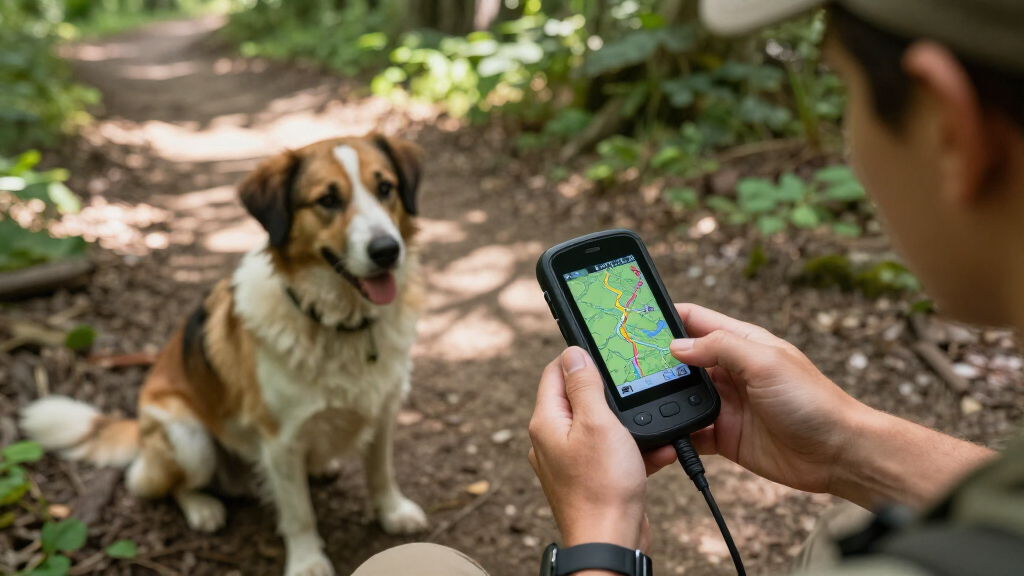
These products were evaluated based on their tracking accuracy, durability, battery life, ease of use, and overall value. We prioritized devices that are specifically designed for outdoor adventures with dogs, considering how well they handle harsh conditions and provide reliable signals. Our ranking reflects a balance between advanced features—like satellite communication and training capabilities—and practical factors such as price, weight, and user interface. The goal was to identify options suitable for various budgets and experience levels, from casual hikers to serious outdoor enthusiasts.| handheld GPS for hiking with dog | Battery Life |
|---|---|
| Garmin Alpha 200i Dog Tracking | up to 20 hours |
| Garmin Alpha 10 Handheld Track | — |
| Garmin Alpha 200 Handheld Dog | up to 20 hours |
| Garmin eTrex 22x Rugged Handhe | up to 25 hours |
| Garmin Alpha 300i TT25 Bundle | — |
| Garmin Alpha 200i GPS Dog Trac | — |
| Handheld GPS for Hiking | up to 36 hours |
| Garmin Alpha 200 Plus Dog Trac | up to 55 hours |
| Garmin Alpha 300 Handheld | up to 55 hours |
Factors to Consider When Choosing Best Handheld GPS For Hiking With Dogs
Choosing the best handheld GPS for hiking with dogs involves understanding several key factors. Beyond basic navigation, you want a device that reliably tracks your dog’s location, withstands tough outdoor conditions, and offers features that match your hiking style. Considering these broader aspects helps avoid common pitfalls, like purchasing a device that’s too fragile or lacking in necessary features for your specific needs.Tracking and Communication Capabilities
Effective tracking is the core reason for choosing a handheld GPS for hiking with dogs. Devices with real-time GPS and GLONASS or multi-GNSS support provide better accuracy in challenging terrains. Many top models also include satellite communication, like inReach technology, which allows you to send messages or SOS signals in remote areas. Be aware that more advanced tracking and communication features typically come at a higher cost and increased complexity.
Durability and Waterproofing
Hiking outdoors means exposure to rain, mud, and rough handling. Look for devices with rugged, waterproof ratings (like IPX7 or IPX8) and reinforced casings. Cheaper or lighter models might sacrifice durability, leading to potential damage or failure in tough conditions. Remember, investing in a more rugged device can save money and stress if your adventures often involve challenging environments.
Battery Life and Power Management
Long hikes demand devices that last for hours without recharging. Some GPS units offer 20-36 hours of battery life, which is ideal for full-day adventures. Consider whether the device has replaceable batteries or can be charged via portable power banks. Shorter battery life may require carrying extra batteries or risking losing track of your dog in critical moments.
User Interface and Ease of Use
During active hikes, quick access to information is vital. Devices with intuitive menus, large displays, and straightforward controls help you focus on the trail rather than fiddling with settings. Features like preset tracking modes or simple one-button operation can make a big difference, especially when managing your dog’s movements or training cues on the go.
Price and Overall Value
While premium models offer extensive features, they also come with higher prices. Budget options can be suitable for casual hikers or those new to GPS devices, but they might lack advanced tracking or ruggedness. Analyzing what features are most important for your specific needs helps avoid overspending on unnecessary capabilities or, conversely, ending up with a device that doesn’t meet your expectations.
Frequently Asked Questions
Can I use a standard handheld GPS for tracking my dogs?
Standard handheld GPS units typically focus on navigation rather than tracking pets. To effectively monitor your dog’s location, a GPS device with dedicated dog tracking features, such as the Garmin Alpha series, is necessary. These devices combine GPS with radio or satellite signals specifically designed for pet tracking, providing real-time location updates and training options. Relying solely on a basic GPS may leave you without the vital tracking capabilities needed for safety and training.
How important is waterproofing for hiking with dogs?
Waterproofing is highly important because outdoor conditions are unpredictable. Rain, mud, or accidental splashes can damage non-waterproof devices, leading to failure at critical moments. A device with an IPX7 or higher rating ensures it can withstand immersion or heavy rain, giving you peace of mind during wet or muddy hikes. Investing in waterproof gear can extend the lifespan of your device and ensure consistent performance in all weather conditions.
Should I prioritize battery life over other features?
Battery life is crucial, especially for long hikes that extend beyond typical battery durations. A device with longer battery capacity ensures continuous tracking without needing frequent recharges or carrying extra batteries. However, balancing battery life with other features like ruggedness and accuracy is important. Sometimes, sacrificing some advanced features for longer-lasting power can be a smarter choice for extended outdoor adventures.
Are more expensive GPS units worth the additional cost?
Higher-priced GPS devices often come with enhanced durability, more accurate tracking, and additional features like satellite communication or training tools. If your hikes are frequent, involve challenging terrain, or require emergency communication, investing in a premium model can significantly improve safety and convenience. However, for casual or occasional use, a mid-range device might provide enough functionality at a more affordable price point.
Can I use a GPS device for both hiking and training my dog?
Yes, many GPS units like the Garmin Alpha series combine navigation with training capabilities, making them versatile tools. These devices allow you to track your dog’s location while also offering training commands and modes to modify behavior. When choosing a device for both purposes, ensure it has easy-to-use training features and quick access to tracking information, so you can switch seamlessly between navigation and training during your hike.
Conclusion
For the casual hiker with a friendly dog, the Garmin eTrex 22x offers reliable navigation at an affordable price. Serious trail users or those in rugged environments will appreciate the Garmin Alpha 200i for its advanced tracking and satellite communication. If you’re new to GPS devices, the Garmin Alpha 10 provides an intuitive experience without overwhelming features. For those with specific needs like training or extended hikes, models like the Garmin Alpha 300i TT25 Bundle stand out. Ultimately, your choice depends on your hiking style, terrain, budget, and whether you prioritize tracking, durability, or ease of use.
Halloween Picks
halloween
As an affiliate, we earn on qualifying purchases.